The Wind Forecasting Improvement Project (WFIP2), a $5 million collaborative study coordinated by Vaisala, a global leader in environmental and industrial measurement, in conjunction with the National Oceanic and Atmospheric Administration (NOAA), and funded by the U.S. Department of Energy (DOE), has completed the largest deployment of measurement technologies to assess the causes of wind-speed variability and their impact on wind energy generation in complex terrain.
The three-year project, based near the Columbia River Gorge, now advances into its 12-month final phase as Vaisala and its project partners use the data collected to enhance the underlying forecasting models used to predict wind variability in areas of challenging topography. Simultaneously, the measurement campaign data have been made open-source to help improve the global standards of wind-energy modeling and to aid further research.
Grid Integration, in Remote Regions
As onshore wind development and operations are increasingly undertaken in regions of challenging topography worldwide, demand for a better understanding of atmospheric flow and wind behavior in complex terrain is increasingly urgent. Currently, the uncertainty associated with wind generation results in less favorable financing terms for projects in development and hinders full use of a free and clean energy source for projects already online.
WFIP2 brings together experts from government, industry, and academia to tackle this issue by improving the ability to understand and forecast wind energy in difficult topography. This will make it possible for the grid to better leverage the U.S.’s significant wind resources and expand the number of places where wind energy is not only feasible, but also profitable.
Wind forecasting has already played a substantial role in making wind power part of the mainstream energy industry. Accurate forecasts allow operators to schedule and trade energy, supporting better overall management of the grid. They also help drive down operational costs by reducing imbalance penalties and facilitating better maintenance scheduling to avoid stranded crews and equipment, while improving personnel safety.
An Unprecedented Scale
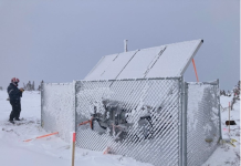
WFIP2 seeks to improve existing models of wind variability, using the dataset collected during an extensive 18-month measurement campaign covering a 50,000-square-kilometer area of the rugged Columbia River Gorge region. Project teams deployed more than 200 measurement devices of more than 24 different types, ranging from SoDAR (Sonic Detection And Ranging) and LiDAR (Light Detection And Ranging) units to wind-profiling radars, radiative flux systems, and microbarographs. Capable of measuring wind conditions throughout the turbine rotor layer and aloft along with other variables, such as cloud position or air temperature, this broad combination of devices has allowed a much deeper insight into wind activity than a conventional anemometer.
“Deploying cutting-edge measurement technology on an unprecedented scale has allowed our project to collect high-value data in an understudied and complex domain,” said Dr. James McCaa, manager of advanced applications at Vaisala and principal investigator for WFIP2. “The resultant data, much of it related to seldom measured atmospheric phenomena, will enable the profound enhancement of current forecasting methodologies, with applications throughout the wind-energy sector, both in the United States as well as overseas.”
Putting Project Data to Use
Over the coming 12-month period, project collaborators will use this dataset to upgrade existing forecasting models, with a focus on zero-to-24-hour-ahead wind forecasts. These models consist of the widely deployed Weather Research and Forecasting (WRF) model, which is used in both the National Oceanic and Atmospheric Administration’s (NOAA) Rapid Refresh (RAP) and High Resolution Rapid Refresh (HRRR) modeling systems. Improvements to these models in complex terrain promises to increase the degree of accuracy to which short-term wind variability can be predicted.
Furthermore, the open-source data will afford opportunities that extend beyond the stated aims of WFIP2, with the potential to enrich further studies into wind variability, benefitting industry stakeholders and consumers alike.
“It is exciting to share the project’s rich dataset publicly, which will be a valuable resource for the industry and wider research community to further its own understanding of wind behavior and modeling,” McCaa said. We look forward to seeing the directions others take this and encourage them to share their findings with us.”
Vaisala was selected to lead WFIP2 because of its work on numerous U.S. and overseas grid integration studies as well as its substantial renewable energy forecasting experience, which spans nearly two decades and includes forecasting 150 GW of global wind capacity on an ongoing, hourly basis.
Source: Vaisala Corporation
For more information, go to www.vaisala.com


